Hiking Teapot Mountain was the highlight of Day 6 of our Eastern Taiwan Tour. In fact, there were so many attractions located along Northeastern Coast of Taiwan that our initial plan was to set off from Luodong at 4am.
What? Such ungodly hours! Why so early?
If you stay till the end of this story, you would probably suggest that we set off earlier.
Other than hiking Teapot Mountain, we also visited Bitou, Nanya, Yin Yang Sea and Shifen Waterfall. Continue reading and check out our self-drive adventure and witness the hottest hiking experience we’ve ever had! It was intense!
Beautiful Road Scenery | Self-drive along Northeast Taiwan
(6am)
And so…we failed to depart our hotel by 4am. In exchange for that two hours of extra sleep, we had to scrap a few attractions such as Sijiaoku Lookout (四角窟觀景台), Sandiaojiao Lighthouse (三貂角燈塔) and Sandiaojiao Castle (三貂角碉堡).
To my realization much later in the day, I was actually at the peak of my illness. No wonder I couldn’t wake up on time, which is quite a rare occurrence based on my track record. To cut short journey time, we took an inner highway instead of driving along the coastline.
Although I drifted in and out of sleep, I did notice how beautiful the road scenery was in this part of Taiwan. I wish I could stay awake longer to take in this unexpectedly charming view!
TIP: You can read about my cheap and fuss-free car rental experience in 2019 or view live rental rates here.

Second Attempt at Hiking Bitoujiao Trail
(7.30am)
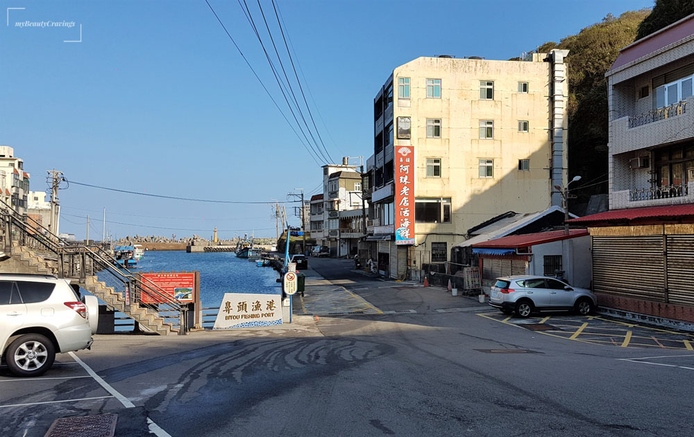
After driving 1.5 hours from Luodong, we arrived at Bitou (鼻頭). A cafe that we’d wanted to visit and which was located near to Bitoujiao trail entrance (Cafe 67) wasn’t opened when we arrived. With no alternative breakfast options in sight in the sleepy neighborhood, we drove out to a humble-looking eatery located along the highway, which we’d earlier spotted.
Breakfast along the Highway, at Bitou
It was interesting watching the lady owner at 麥香屋 (pronounced as Mai Xiang Wu) handled everything from orders-taking to cooking and serving. We did also observe a man, probably her spouse, entering and leaving the shop while wearing a helmet. He seemed to be handling delivery service.
With one woman manning the shop, service was a little slow.
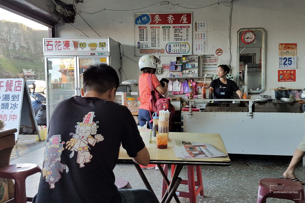
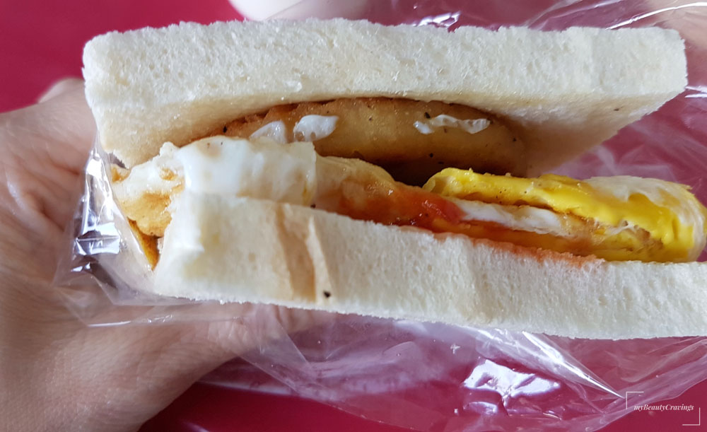
Here’s what we ordered – simple Taiwanese breakfast comprising sandwiches and soybean milk. Food was very affordable. I believe this cost NTD25.
Click here for map location of this early breakfast option around Bitou.
Denied Entry to Bitoujiao Trail…Again!
Breakfast is done. Let’s go for a hike. And so we returned to Bitou Fishing Port in search for the entrance to Bitoujiao Trail. A few guys who appeared to be in construction garb stood at the entrance of a stairway and told us that the trail was closed for maintenance.
“You mean all trails are closed?”, I asked while clinging to a faint glimmer of hope as I knew there was another way to access it, via Bitou Elementary School.
“Sorry guys, all trails are closed for now!”
Were we disappointed? You bet!
I’d missed Bitoujiao in my earlier solo trip and had to miss it again on my second attempt. Furthermore, we’d given up Sandiaojiao for Bitoujiao trail (鼻頭角步道) but couldn’t even place a foot within it. So near, yet so far!
If you are heading to Bitoujiao, I believe they are opened to the public now. Do share with me your experience and let me grow green with envy.
Location of Bitoujiao Trail
Click here for map location. Bitoujiao trail can be accessed from Bitou Fishing Port or Bitou Elementary School.
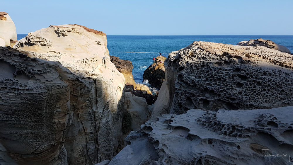
See Nature’s Masterpiece at Nanya
(8.30am)
The second stop was Nanya, which was located by the coast and next to the highway. There were some roadworks taking place forcing us to make a few u-turns before being able to turn into the designated stopping point for Nanya.

At Nanya, you get to see unique rock formations, shaped through years of erosion. If you have been to Yehliu Geopark or Western Australia’s Pinnacles, you may not be wowed by Nanya. However, every place is unique in its own right and if you happen to be around this area, just pop by.
You can even do some mini climbing and get really close to the rocky shore.
TIP: Not driving or not engaging a driver? You can still reach the beautiful northeast coast of Taiwan with this Northeast Coast Scenic Day Tour. If you are feeling adventurous, you can make use of the Taipei Transport Fun Pass and board the Golden Fulong Shuttle Bus.
Location of Nanya, Taiwan
There were several places along the coast to view Nanya Rocks. We’d stopped at a few including one with a big boulder facing the road. See map location.
Yin Yang Sea and its unique color palette
(9am)
Next up was Yin Yang Sea, a popular sight where the sea was a mix of blue and yellow. It wasn’t that spectacular when viewed on ground level. This, we know, because Yin Yang Sea was so stunning when we viewed it from further uphill.
Read on. Don’t miss the pretty sight of Yin Yang Sea when viewed from Teapot Mountain.

Location of Yin Yang Sea
See google map location for ground-level viewing, by the coast.
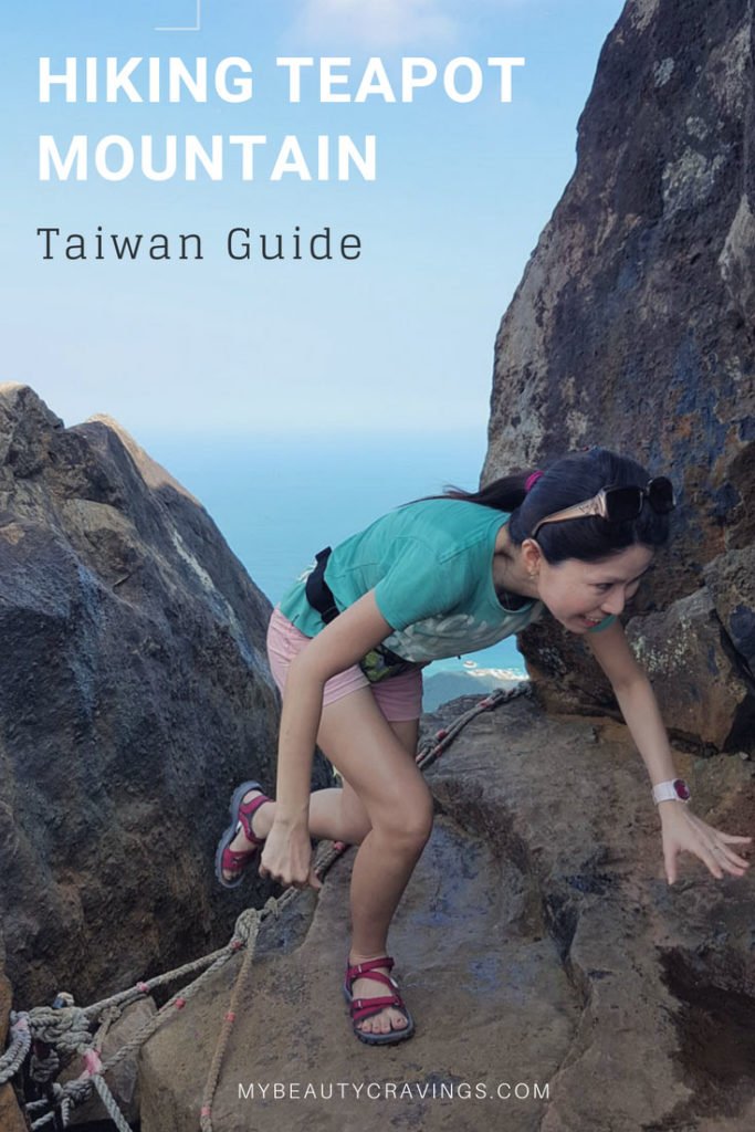
Teapot Mountain – Hottest Hiking Experience
(9.40am)
Hiking up Teapot Mountain was the highlight of today’s itinerary. This was also the reason why we had to get up early if we didn’t want to be roasted by the afternoon sun.
We parked our car outside Chuen Ji Hall (金瓜石勸濟堂) located near Jinguashi. Upon stepping out of our car, we knew we were in for a real ‘toasting treat’. It was intense. The heat was fierce. It was nothing like what we were expecting.
I am pretty sure the temperature was way above 35 degree Celsius, as the sun that shone on us threatened to BBQ us alive. This was the exact same climate as experienced in my earlier trip to Jinguashi – both in October. Why Jinguashi was so hot during autumn remains a mystery to me.
I made a quick decision to buy two bottles of icy cold mineral water (in addition to our hydration pack) from a store located next to the temple and made our way to the trail entrance of Teapot Mountain (see map location).
Get Ready for a Steep Climb up Teapot Mountain
If you are expecting a flat hike to warm you up to Teapot Mountain, you’ll be in for a rude surprise.
The climb up Teapot mountain was steep and started right from the trail entrance. It was so steep I wondered when it would end, but it just kept going…UP!
“Can’t you stop and take a rest?”, you might be asking.
Sorry, pal. We were under the direct grill of the sun. Stopping would mean longer grilling time. Look at my face – how white it was because of the sun’s direct glare. Imagine this to be on my face for the next 80 minutes. So, although we were tired, we couldn’t stop to take a breather.
I slathered on my SPF100 Waterproof sunblock repeatedly, over wet and sweaty skin. It was sticky and uncomfortable.
Within just 15 minutes, I was soaked to my undies in my own perspiration. This is by far the most uncomfortable hiking experience I’ve had and I did quite a bit of hiking in Malaysia, Thailand, Indonesia, Taiwan, Japan, Korea, New Zealand and Australia.
How could hiking be this hot? LOL. What’s more, I was climbing Teapot Mountain while having a fever (which I realized only much later).
Look at the locals who were in the know of things. They were covered up from head to toes with hats, sunglasses, scarf, gloves, long-sleeved tops and long tights. Even their ears were protected. LOL. They were brilliant!
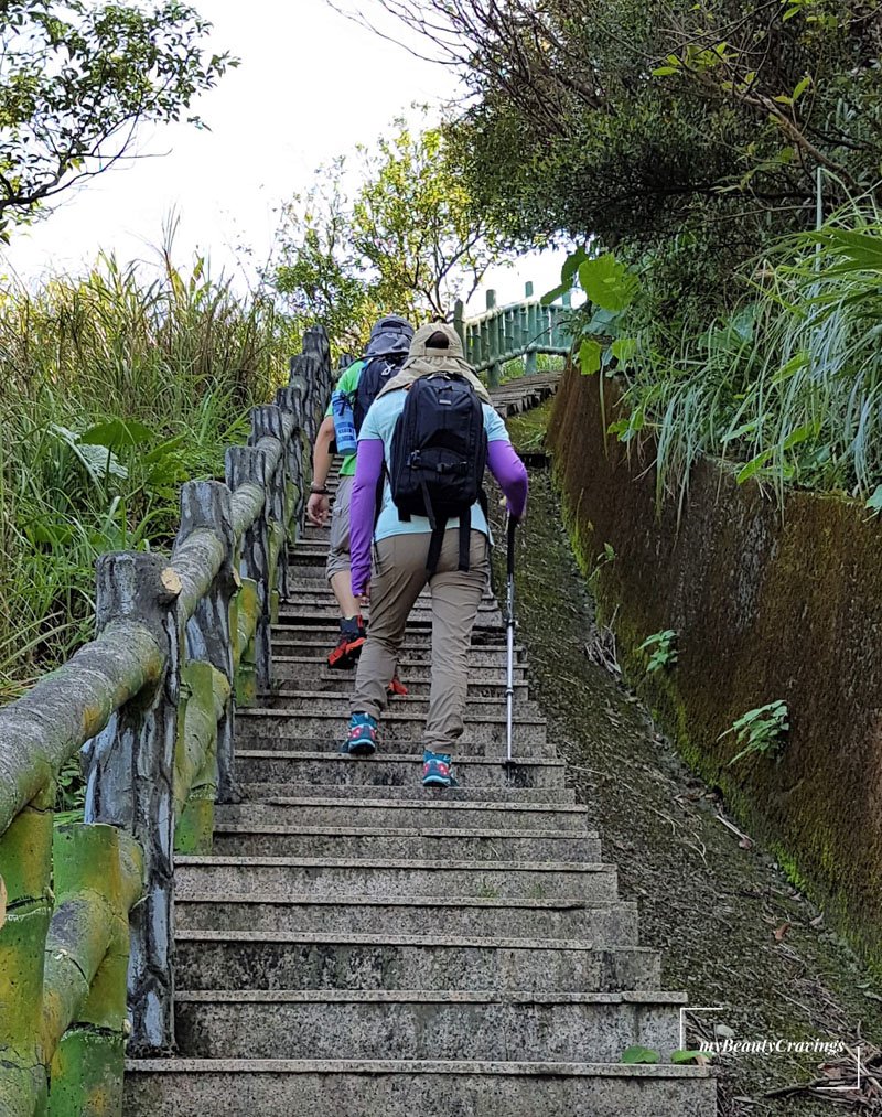
And look at us. We were dressed like amateurs in T-shirts, shorts and no hats.
Come on, who knew such an easy hike on paved ground could be made difficult by the angry sun?
At this point, I was thankful that we didn’t get to hike Bitoujiao trail. Because if we did, we would have reached Teapot Mountain by noon when the sun was at its hottest. OMG! I don’t even want to think about how bad the situation would have been.
TIPS: If you want to climb Teapot Mountain (and I strongly encourage you to), please wear proper hiking gear that can protect you from the sun. Also, bring lots of water – it’ll be consumed in no time because you’ll keep perspiring. We finished about 1.5 litres of water each.
Alternatively, start your climb as early as possible before the sun rises.
Recommended Attire when hiking Teapot Mountain
I did some shopping and found these items similar to what those locals were wearing. The locals did it right by protecting themselves against the harmful effects of sun exposure.
Our Rewards – Spectacular Views hiking Teapot Mountain
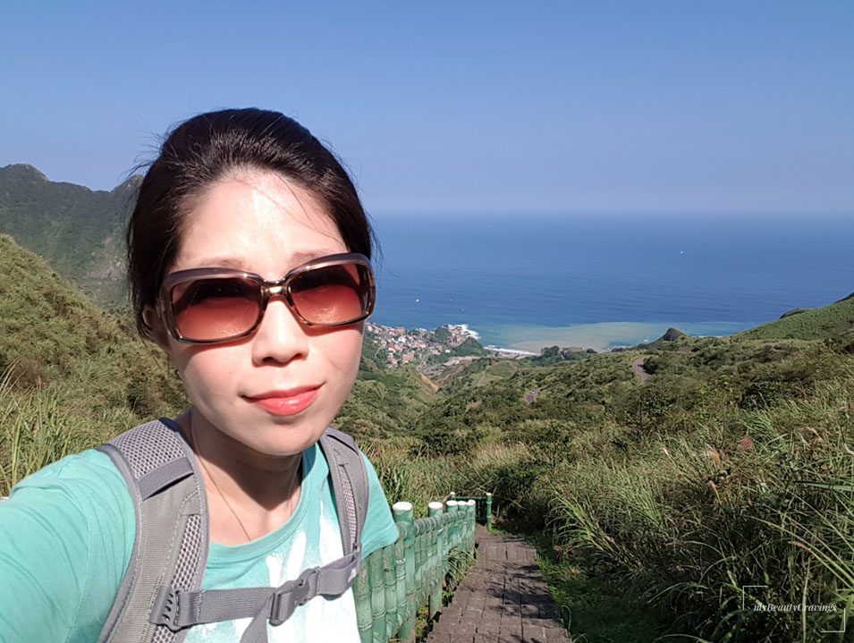
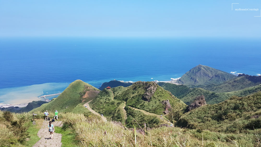
Despite the difficult climb, I did not regret hiking Teapot Mountain. The scenery at various viewing points was beyond spectacular. Yin Yang Sea was an impressive sight from this vantage point. You could clearly see the mix of yellow and blue in the sea.
> MUST-READ: We hike Hehuanshan in Taiwan – Here’s how you can do it too

The clear blue sea and dreamy horizons were worth the roasting experience. But the thought of doing it again still frightens me – specifically the agony of being roasted alive.
See the photo below where I took in the expanse of the ocean view. This is one of the best scenery photos I’ve taken in a while. But to be honest, I was struggling with the heat even when taking a short breather at the viewing platform.
The sun probably made the photo turned out so perfect. This, we realized much later because when we were there, it was so glaring we couldn’t see what was on the mobile screen. We just randomly snapped! LOL.

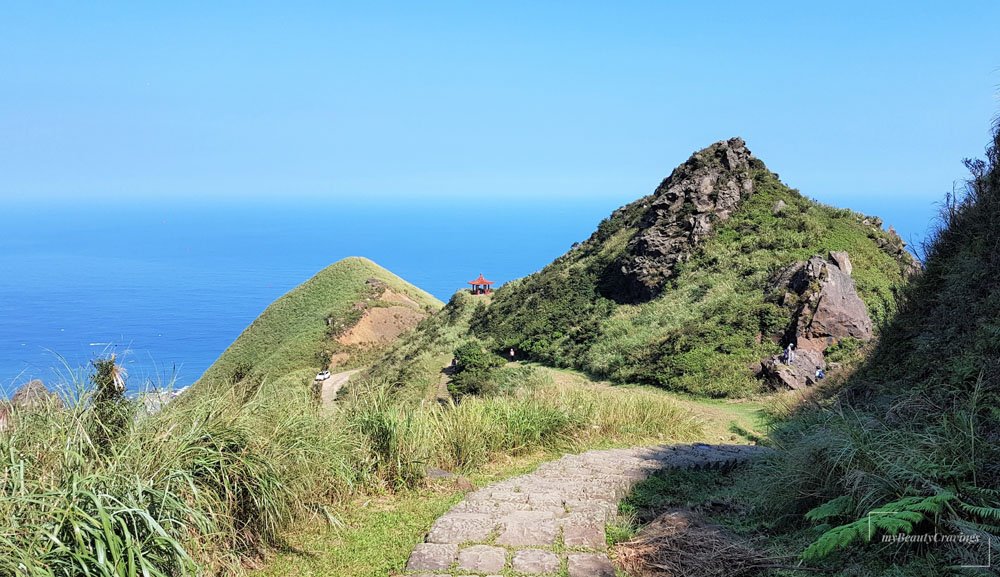
The Summit of Teapot Mountain
(11am)
Nearing the summit was a trail of rocky path. By then, we could see the ‘teapot’ in full sight. It was a rock with a hollow that allowed one to climb within and emerge from its roof to reach the summit (i.e. top of teapot lid).


Only one person could squeeze through the teapot at a time and hence we witnessed some crowding around the teapot.

With the help of ropes, I mounted myself vertically through the upper hollow. I wouldn’t say it’s a walk in the park but it was manageable. I was super impressed when I saw a Taiwanese grandpa making the hike. He even offered to help us with couple shots!

By the time I reached the summit, it was 11am. That’s 80 minutes of a mostly vertical climb and so I’d to take some obligatory summit photos. It didn’t turn out pretty because I was frowning under the sun’s direct glare – frown lines and all for all to see.
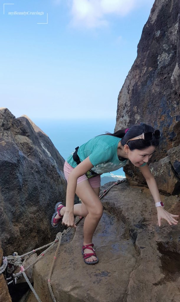
The summit being at the tip of the teapot lid was on a small, uneven and precarious rock surface. There isn’t sufficient space to move around to get a full body shot. I touched the boulder for an added sense of security.


Descending Teapot Mountain was a breeze
What took us 80 minutes to climb took just one-third of the time to descend. After 25 minutes, we were back to the parking area. The first thing we did was to buy a few more bottles of mineral water. I was so thankful that their mineral water was so icy cold. It was a great way to bring down our body temperature.
Location of Teapot Mountain
Teapot mountain is located here. If you drive, park your vehicle outside Chuen Ji Hall (金瓜石勸濟堂). If you are on public transport, travel to Jinguashi (see instructions) and follow park signage that points you to Teapot Mountain (茶壺山步道口) – see map location for trail entrance.
I was surprised that I could climb this mountain while having a fever. I think it was endorphin and adrenaline that kept me going. Because right after the hike, it was a different story. I’ll share more with you in my next post where I’ll also cover itineraries for the second half of Day 6. Stay tuned!
Essential Info:
|
Do you want to hear about the fun things I do as a budget-savvy free and easy traveler? Just click the button below to subscribe. I’ll even give you some free and exclusive stuff. See you there!
SUBSCRIBE
This post may contain affiliate links, meaning I earn a commission if you make a purchase, at no cost to you. Read my full disclosure for more info.
Related Posts:
- Day 1 (pt 1): How to get from Taipei to Hualien!
- Day 1 (pt 2): How to rent a scooter in Hualien?
- Day 1 (pt 3): Hualien Dongdamen Night Market on a rainy day!
- Day 2 (pt 1): Taroko Gorge on a Rainy Day
- Day 2 (pt 2): Exploring Shakadang Trail and Chisingtan Beach
- Day 3 (pt 1): Best hike of Taroko Gorge was at Lushui Trail!
- Day 3 (pt 2): Explore Wenshan Hot Spring and Qingshui Cliff
- Day 4: Goodbye, Hualien. Hello, Luodong!
- Day 5 (pt 1): Chasing waterfalls at Wufengchi and Yuemeikeng
- Day 5 (pt 2): Around Yilan – Jiaoxi, Daxi Fishing Harbor, Lanyang Museum, Mr Brown Castle and Jimmy Park
- Day 6 (pt 1): Hiking Teapot Mountain in Taiwan, plus Nanya and Yin Yang Sea
- Day 6 (pt 2): Not in Awe with Shifen Old Street – but Shifen Waterfall deserves a visit
- Day 7: Last day in Taiwan: Explored Luodong and Taipei in one day (Day 7)
")


